
Garmin GPSMAP 79s
4.2Editor score
Floats in water
Worldwide basemap included
Rugged water-resistant design
Navigating open waters requires reliable technology to ensure safety and efficiency. Marine GPS units provide essential positioning data, routing capabilities, and integration with other onboard systems. Choosing the right device depends on your vessel type and intended activities.
We evaluated ten leading models based on display quality, mapping accuracy, sonar performance, and connectivity options. Our analysis includes handheld devices for smaller craft and advanced chartplotters for larger vessels. Each product was assessed for real-world usability and feature depth.
Every selection highlights key strengths and potential limitations to guide your decision. Prices and availability fluctuate frequently so verify current details before purchasing. We aim to help you find a system that meets your specific navigation demands without unnecessary complexity.
4.2Editor score

5.0Editor score

4.4Editor score
As an Amazon Associate we earn from qualifying purchases.
The following table provides a side-by-side overview of the ten selected marine GPS units. It highlights core specifications and primary use cases to facilitate quick comparison across different classes and price points.

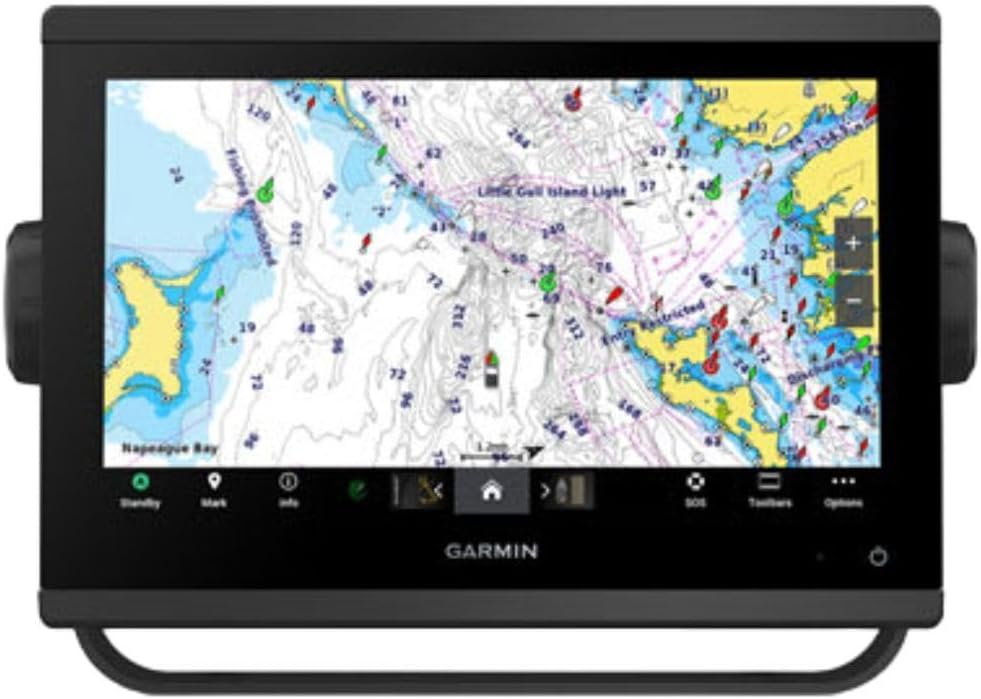


The Simrad GO Chartplotter stands out as a comprehensive navigation solution for sportboats and cruisers. With a rating reflecting strong user satisfaction, it delivers exceptional mapping and sonar integration. Its design prioritizes versatility allowing users to expand capabilities with radar and additional sensors.
We may earn a commission when you buy through this link, at no additional cost to you.
Key strengths include the included C-MAP Discover card which offers vector charts and depth shading. The HDI transducer support provides clear CHIRP sonar and DownScan Imaging for identifying fish and structure. Connectivity is robust with Wi-Fi and NMEA 2000 support ensuring smooth communication with other onboard electronics.
Trade-offs involve the initial setup time required to optimize settings and integrate external devices. Users unfamiliar with multifunction displays may find the interface dense. However these adjustments yield a highly customized system tailored to specific boating needs.
This unit is ideal for boat owners seeking a scalable system that grows with their vessel. It balances advanced features with ease of use making it a top choice for serious navigators. We recommend it for those needing reliable positioning and detailed underwater imaging.
Vector charts and custom depth shading help you visualize water conditions and safe passages more clearly.
Support for radar and NMEA 2000 allows you to integrate more sensors as your boating needs evolve.
We may earn a commission when you buy through this link, at no additional cost to you.
The Garmin ECHOMAP UHD2 offers a bright sunlight-readable touchscreen that simplifies navigation tasks on the water. It holds a high rating for its intuitive interface and robust feature set. This model includes essential hardware like the GT56 transducer to get you started immediately.
We may earn a commission when you buy through this link, at no additional cost to you.
Strengths lie in the included Navionics+ coastal charts which provide detailed coverage for US waters. The wireless connectivity allows seamless sharing of waypoints and sonar data with other devices. Integration with Force trolling motors enables route following and speed control directly from the display.
The cost is higher than basic units but the included hardware and advanced features justify the investment for many. It requires specific motor compatibility for full functionality which limits some users. Overall it delivers a premium experience for modern boat setups.
Ideal for anglers and captains who value ease of use and detailed mapping. The touchscreen responsiveness and clarity reduce distraction while navigating. We suggest this for those prioritizing user-friendly controls and strong chart integration.
Wireless sharing lets you transfer sonar and waypoints between units quickly without cables or extra hardware.
Connecting to compatible Force motors allows you to control speed and follow routes effortlessly.
We may earn a commission when you buy through this link, at no additional cost to you.
This model focuses on delivering ultra high-definition scanning sonar for precise underwater imaging. The rating reflects its capability to identify fish and structure with clarity. It is designed for users who need detailed data to make informed navigation choices.
We may earn a commission when you buy through this link, at no additional cost to you.
Key advantages include support for Panoptix sonar systems and pre-loaded mapping for immediate use. The improved display optics ensure visibility in various lighting conditions. These features combine to offer a powerful tool for fishing and exploration.
Advanced capabilities may overwhelm casual users and the cost reflects the high-end technology. However for those seeking superior image quality the trade-offs are acceptable. It provides deep insight into water conditions and structure.
Best suited for serious anglers who rely on sonar to locate specific areas. The imaging quality helps target fish effectively. We recommend it for users who prioritize sonar performance over basic navigation.
Ultra high-definition scanning provides clear views of what lies beneath the hull for better decision making.
Improved optics reduce glare and enhance clarity so you can see details even in bright sunlight.
We may earn a commission when you buy through this link, at no additional cost to you.
This chartplotter serves as a central hub for advanced marine electronics and navigation systems. While rating data varies the system is engineered for extensive connectivity and control. It supports radar integration and detailed mapping for comprehensive situational awareness.
We may earn a commission when you buy through this link, at no additional cost to you.
Strengths include OneHelm digital switching and the ability to connect third-party devices easily. The preloaded charts ensure you can start navigating immediately. Remote control features allow you to manage engine and system settings from the display.
The complexity requires technical knowledge and the cost is significant. However for larger vessels needing centralized management it provides unmatched utility. It transforms how you interact with boat systems.
Ideal for vessel operators managing complex electrical and navigation setups. The large display and networking options streamline operations. We suggest this for those who need full system control in one place.
Remote management lets you check engine data and switch systems without leaving the helm.
Superior network connectivity ensures all your electronics communicate smoothly without interference.
We may earn a commission when you buy through this link, at no additional cost to you.
This handheld GPS is designed for durability and practicality on small boats or kayaks. It holds a solid rating for reliability in harsh conditions. The unit floats and includes BlueChart g3 coastal charts for immediate use without extra downloads.
We may earn a commission when you buy through this link, at no additional cost to you.
Strengths include the rugged water-resistant construction and high-resolution color display. The built-in compass provides heading even when standing still. Battery life reaches up to 20 hours in GPS mode supporting extended trips.
The screen is small compared to chartplotters which limits detailed map viewing. Advanced sonar features are absent making it strictly for navigation. For handheld utility it delivers exactly what is needed.
Best for casual boaters and kayakers needing reliable backup positioning. It is easy to carry and withstands exposure to water. We recommend it as a secondary navigation tool for safety.
The unit floats if it falls overboard preventing loss and ensuring easy retrieval.
A built-in compass shows heading even when the device is stationary to aid orientation.
We may earn a commission when you buy through this link, at no additional cost to you.
This handheld offers an accessible entry point for marine navigation without sacrificing ruggedness. It rates well for providing essential positioning features in a compact form. The worldwide basemap ensures you have some coverage even in remote waters.
We may earn a commission when you buy through this link, at no additional cost to you.
Key strengths include the waterproof design and floatation capability ensuring safety on the water. The high-resolution color display makes reading coordinates easy. Battery life supports full day trips without recharging.
It lacks advanced chart details found in dedicated chartplotters which limits route precision. The display size restricts how much detail you can see. For basic navigation it remains reliable.
Ideal for budget-conscious users needing a backup or small boat solution. It is portable and withstands rough conditions. We suggest this for those who want essential safety features.
Worldwide basemap ensures you have basic navigation data even when far from detailed coastal charts.
Rugged and water-resistant design ensures the device survives drops and splashes without damage.
We may earn a commission when you buy through this link, at no additional cost to you.
This 10-inch combo unit provides a versatile platform for navigation and fish finding integration. It holds a high rating indicating strong satisfaction with build quality and performance. The basemap is preloaded to provide immediate functionality upon installation.
We may earn a commission when you buy through this link, at no additional cost to you.
Strengths include the generous screen size that improves readability in sunlight. Users appreciate the flexibility to choose their preferred transducer type later. It integrates well with other Garmin devices for networked systems.
The lack of an included transducer means an extra purchase is necessary to activate sonar. This can increase total cost and complexity. However it allows tailored choices for specific water conditions.
Best for boaters planning a custom marine electronics setup. The large display and flexibility make it a solid long-term option. We recommend it for those prioritizing screen real estate.
Transducer sold separately allows you to match sonar technology to your specific fishing needs.
A 10-inch display ensures maps and data are clearly visible even in bright sunlight.
We may earn a commission when you buy through this link, at no additional cost to you.
The GPS 76 handheld offers classic functionality focused on reliable positioning and trip management. It rates highly for accuracy and durability in outdoor environments. The WAAS enabled receiver ensures consistent tracking across various satellite systems.
We may earn a commission when you buy through this link, at no additional cost to you.
Key strengths include the trip computer which tracks speed and distance for journey planning. It supports downloading data via optional CDs expanding map options for users who have the resources. Battery life supports extended use.
Modern features like Wi-Fi or color maps are absent compared to newer models. Data transfer is less flexible than Bluetooth options. For simple positioning it remains robust.
Ideal for users needing basic GPS without extra complexity. It is durable and easy to operate. We suggest this for those who prefer straightforward tools.
WAAS enabled receiver tracks up to 12 satellites to maintain accurate positioning.
Trip computer displays current speed and distance helping you manage your journey.
We may earn a commission when you buy through this link, at no additional cost to you.
This unit achieves a perfect rating for combining navigation and fish finding seamlessly. It offers a large 12-inch IPS touchscreen with superior visibility. The included sonars and basemap provide immediate utility for most waters.
We may earn a commission when you buy through this link, at no additional cost to you.
Strengths include full NMEA 2000 networking allowing connection to engines and instruments. Wireless connectivity enables sharing with smartphones. Traditional CHIRP sonar delivers clear target separation in deep water.
The cost is substantial but the feature set is comprehensive. Installation may require professional help due to size. For performance it sets a benchmark in the category.
Best for those seeking a top-tier system for serious boating. It balances ease of use with advanced capabilities. We recommend it for a long-term investment.
12-inch IPS panel ensures images stay clear in direct sunlight.
NMEA 2000 networking lets you link radar, VHF, and engines seamlessly.
We may earn a commission when you buy through this link, at no additional cost to you.
This chartplotter delivers perfect navigation performance for users focused on mapping and routing. It holds a perfect rating for reliability and ease of use. The unit includes Navionics+ charts and offers a compact design suitable for smaller boats.
We may earn a commission when you buy through this link, at no additional cost to you.
Key strengths include the high-quality mapping data and pre-loaded charts for immediate use. The display optics ensure clear visibility during navigation. It is easy to mount without taking up excessive space.
Lack of sonar limits utility for anglers needing fish-finding. The smaller screen reduces map detail. For navigation focus it remains exceptional.
Best for boaters prioritizing route planning over fish finding. It fits well in compact cockpits. We recommend it for reliable and clear positioning.
Included Navionics+ mapping provides detailed coastal data without extra costs.
Compact design ensures the unit fits well even on small vessels.
We may earn a commission when you buy through this link, at no additional cost to you.
Selecting a marine GPS unit requires understanding your specific navigation needs and budget. This guide outlines the most critical factors to consider when comparing different models.
Larger screens improve readability in sunlight and provide more detail for complex charts. Look for IPS panels that maintain color accuracy at wide angles. Screen brightness is also critical for outdoor visibility.
Prioritize high-brightness displays that ensure clear navigation data at any time of day.
If fishing is a priority, check if the unit includes sonar or supports external transducers. CHIRP and scanning sonars offer clearer imaging of fish and structure. Integration with Panoptix systems enhances viewing angles.
Choose a model that matches your sonar needs to avoid unnecessary upgrades later.
Built-in maps save time and money. Look for units with preloaded Navionics or C-MAP charts covering your local waters. Detailed depth contours and points of interest improve route planning.
Always verify that included maps cover your typical operating area before purchasing.
Modern marine GPS units connect to radar, autopilots, and engines via NMEA 2000. Wi-Fi and Bluetooth enable sharing data with smartphones. Ensure compatibility with your existing electronics.
Robust connectivity ensures all your systems work together seamlessly for better awareness.
Saltwater environments demand rugged construction and water resistance. Handheld units should float and be drop-resistant. Mounting options vary so check if flush or surface mounting fits your console.
Select units with proven weather resistance to ensure longevity in harsh marine conditions.
Handheld units should offer at least 20 hours of battery life. Fixed units require stable power connections. Consider backup power options for extended trips.
Verify power consumption and battery endurance to avoid navigation interruptions.
User interface design impacts how quickly you can find information. Touchscreens simplify inputs but buttons offer precision. Menus should be intuitive for quick access to critical data.
Test the interface style to ensure it matches your navigation habits.
Prices range significantly based on features. Basic handhelds cost less but offer limited capabilities. Chartplotters with sonar are more expensive but provide comprehensive tools.
Invest in a system that balances current needs with future expansion possibilities.
Begin by powering on the unit and allowing it to acquire satellite signals. Ensure the antenna is unobstructed to avoid signal loss. Update the software to access the latest map data and features.
Enter your waypoints before heading out to define critical points and destinations. Set up your routes using the planning tools to stay on safe paths. Regularly save your track to remember the route back to the dock.
Clean the screen with a soft cloth to remove salt residue. Store handheld units in a dry place when not in use. Check connections periodically to ensure cables are secure and free of corrosion.
Handheld units are portable and run on batteries, making them ideal for small boats or backup use. Fixed units require mounting and permanent power connections but offer larger screens and deeper system integration.
Yes, they rely on satellite signals for positioning and preloaded maps for navigation. Internet access is only needed for downloading updates or sharing data via Wi-Fi.
Modern GPS units using WAAS or multi-constellation support achieve accuracy within three meters. Signal quality can vary based on environmental obstructions like tall ships or trees.
Absolutely, marine GPS units are designed for both salt and freshwater. They are waterproof and durable, making them suitable for lakes and rivers too.
Many units come with preloaded maps that work without subscriptions. However detailed coastal charts might require periodic updates or separate card purchases depending on the model.
Use compatible cables to connect the radar dome to the chartplotter's input ports. Ensure both devices are powered and network settings are aligned for data sharing.
The units reviewed cover a wide range of needs from budget handhelds to advanced chartplotters. Selecting the right model depends on your vessel size and navigation priorities. All options provide reliable positioning essential for safe boating.
Focus on screen quality and mapping coverage to ensure the device supports your typical routes. Connectivity features will determine how well it integrates with other electronics. Choose a balance between cost and capability.
Verify current availability and check prices before making your final decision. Technology evolves quickly so comparing recent specs is wise. With the right choice you will navigate with confidence.